Funded by Airbus Space and Defense, SPOT-6 marked a change from French government to private ownership. Improved sensor technology allowed SPOT-6 to generate more accurate elevation maps, contributing to a cadre of Earth Observation projects and databases.
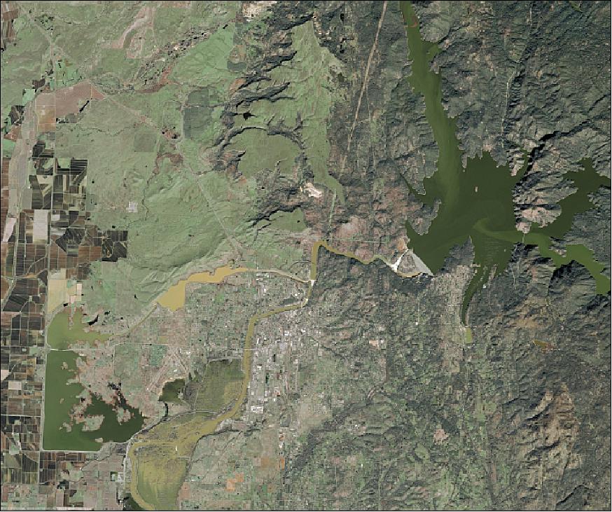
California rain storm when emergency workers and state officials were racing to repair a damaged spillway on the tallest dam in the United States, while almost 200,000 people evacuated downstream of the structure were given no indication of when they might return to their homes Credit: Airbus DS Satellite Image Gallery
Since 1986, the SPOT satellite constellation has imaged over 100 billion square kilometres of Earth, creating a data-rich archive of more than 30 million scenes. Despite the longevity of its predecessors—SPOT 2 operated for over 19 years—the focus of the SPOT missions remained on discovering more about the Earth’s climate and monitoring natural resources. This required new equipment with updated technology.
Astrium Services – now Airbus Defense and Space – fully funded the development of SPOT 6. Though developing SPOT instruments had always relied on collaboration between private and government organisations, the launch of SPOT 6 in 2012 was the first step in Airbus DS taking private ownership of the SPOT programme and its legacy. Over the prior year, CNES had launched Pléiades, a twin satellite constellation designed to advance the mission of the SPOT programme. CNES would officially end their part of the programme when they deorbited SPOT 5 in 2015.
SPOT 6’s design drew upon the decades of technology developed for SPOT 1-5 and Pléiades.
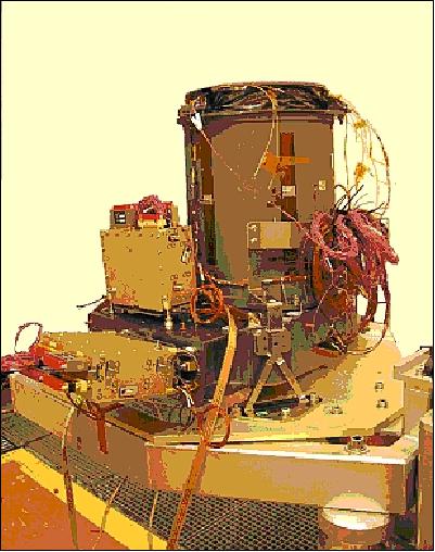
Photo of the NAOMI instrument assembly for the SPOT-6 spacecraft. Credit: EADS Astrium
SPOT 6 is equipped with two identical New Astrosat Optical Modular Imager (NAOMI) instruments designed to gather data on the Earth’s surface albedo and reflectance, vegetation, and land surfaces. Each pushbroom imaging system can capture 1.5 m resolution images with five spectral bands: panchromatic, near-infrared (NIR), blue, red, and green. For continuity, images produced by SPOT 6 also had to maintain compatibility with SPOT 1-5 with the same 60 km wide imaging swath. The twin instruments can operate simultaneously or individually.
Achievements
SPOT 6 balances the need for collecting wide-angle images of large areas and magnifying images of individual targets, with the capacity to image 3 million km2 of the Earth daily. In just the first quarter of 2013, SPOT-6 collected imagery covering 152 million km2. SPOT 7 would launch just a year after SPOT 6, enabling 24-hour revisit capability to any point across the globe.
Furthermore, SPOT 6 and 7 were designed to work in tandem with the very high-resolution Pléiades satellites. They all shared the same orbit, making it possible for intraday revisits to any point on Earth and for image availability within hours. Having a larger fleet of satellites maximises the number of successful acquisitions by minimising conflicts and enabling automatic, rapid reaction to changing conditions and weather—including natural disasters.
SPOT 6 improved collecting data for mapping with the ability to capture images in tri-stereo, an image composed of three scenes taken from oblique angles: forward, backwards, and above. Adding the vertical angle greatly enhances the quality of elevation data taken from the stereo images. With traditional stereo pairs, images of targets acquired over steep terrain or dense metropolitan areas might be missing critical information as low-lying features may be hidden from view in the oblique perspective by high mountains or tall buildings. In tri-stereo, the nadir image peers straight down into natural and constructed valleys to capture all features and ground surfaces, resulting in more complete and accurate DEM (Digital Elevation Model) datasets.
The sensors on SPOT 6 featured a 12-bit pixel depth. Each pixel can take one value out of 4,096 for each spectral band. SPOT-5 had a pixel depth at acquisition of 8 bits, so a given pixel can take one value out of 256. Thus, it displayed less capacity when distinguishing subtle nuances, especially at the beginning or the end of the spectrum.
Thus, it is more likely with SPOT 6 to detect objects in the darkness of the shadow of a building or a mountain, as more information can be taken by each pixel. Similarly, it is easier to detect pale-coloured elements in very light/bright environments (sand, ice, nearly-white ground), according to the same principle, as more saturation problems are avoided.
SPOT 6 is a part of the MARS-CAP campaigns that involve mapping agricultural land throughout Europe to verify declarations relating to cultivated land areas and fallow land submitted by farmers. The European subsidies granted to farmers are based on these declarations and their verification.
The SPOT programme currently works with the GIS mapping engine operator Satshot to provide high-resolution satellite data over a large agricultural area of the United States. SPOT data is integrated into the Satshot platform, which can be used for deep analysis of specific farmland for improved operations and efficiency, such as season-wide crop health monitoring and stress estimation, crop damage assessment for insurance, land use sustainability management, land value, and other precision applications.
Another example of SPOT’s versatility is the Copernicus mission, launched in 2009. It uses the SPOT system to collaborate and process images of the earth in new and revealing ways. Focusing on studying urban development and tracking land use, scientists used observations from SPOT-6 and SPOT-7 to create an extensive and detailed, planet-wide dataset called WorldStat. Around 4000 high-resolution SPOT images – covering approximately 10,000 square km of Earth's surface – were paired with 16 Copernicus Sentinel-2 images. The Sentinel-2 images were captured at regular intervals of about five days and added detail to the wide-angle SPOT images.
ESA offers access to the full SPOT archive for scientific research and application development.
Banner Image: 1.5m SPOT-6 satellite image of the Phalaborwa Mine in South Africa. Credit: AIRBUS Defense & Space all rights reserved www.satinimagingcorp.com

