The US-based National Ocean and Atmospheric Administration (NOAA) seeks to understand and predict changes in Earth’s climate, weather, ocean, and coasts. One of NOAA’s branches – the National Weather Service (NWS) – provides essential weather forecasts to help people prepare and respond to natural and human-caused events.
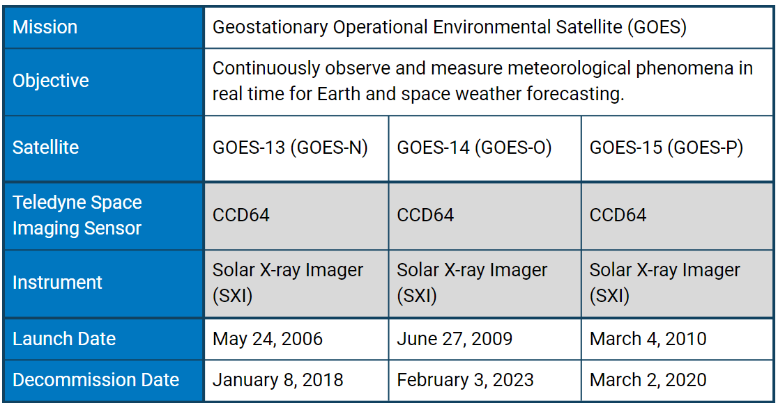
The primary tool of the NWS is the Geostationary Operational Environmental Satellite (GOES) program. Like NASA’s A-Train, GOES is a series of satellites designed to work in coordination. The importance of consistent and frequent weather predictions enforced this need for compatibility, and older spacecraft were often held in a storage orbit in case of failures.
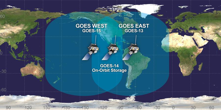
Coverage of GOES satellites. Credit: NASA
NOAA policy calls for the operation of two meteorological satellites in geostationary orbit: GOES-East positioned at 75º W longitude over the equator, and GOES-West positioned at 135º W longitude over the equator plane. A third satellite was kept in storage in order to ensure constant surveillance. This setup extends coverage of the planet from approximately 20º W longitude to 165º E longitude, covering North and South America along with most of the Atlantic Ocean and part of the Pacific Ocean.
With the support of NASA, NOAA has launched 19 GOES satellites. Each GOES satellite is given a letter designation during the planning stages, which is changed to a number once in orbit.
This article focuses on the 3rd generation: GOES-13 (GOES-N), GOES-14 (GOES-O), and GOES-15 (GOES-P). An upcoming article will feature the 4th generation (GOES-R).
Despite a primary focus on the Earth, GOES also collects data on the Sun. While this may seem counterintuitive, space weather can greatly influence conditions on Earth.
How Does the Sun Affect Earth’s Weather?
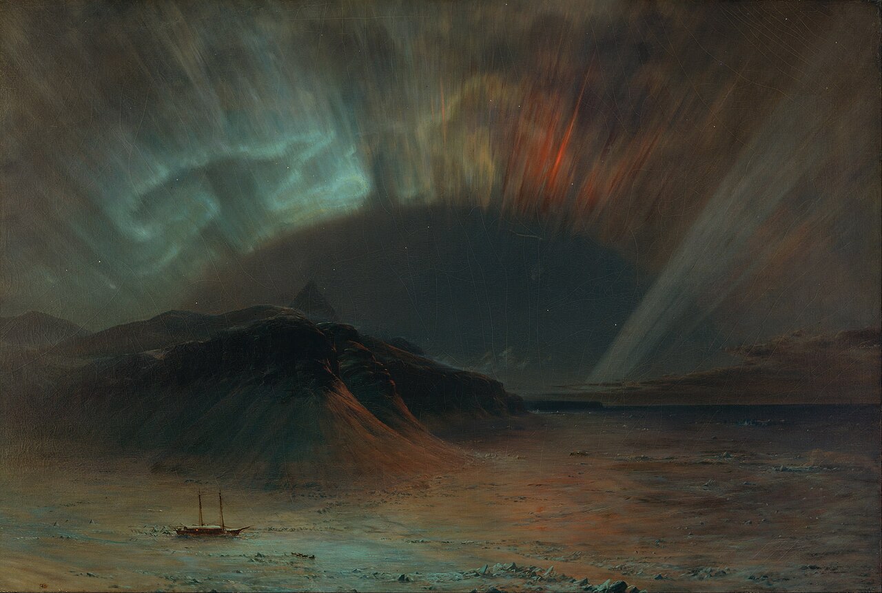
Frederic Edwin Church’s 1865 painting “Aurora Borealis”. Some speculate that Church was inspired by the Great Auroral Storm of 1859, also known as the Carrington Event. Credit: Wikipedia
As we deal with the weather generated on Earth, it’s easy to forget about the weather out in space. No matter how bright the Sun shines, it’s not cutting through a thunderstorm. However, electromagnetic storms generated by solar activity could rival the damage and disruption caused by severe hurricanes.
In 1859, the Earth experienced the Carrington Event – the most disruptive solar storm ever recorded. It was so powerful that it fried telegraph systems throughout Europe and North America and cascaded auroras as far south as Colombia. Since then, our dependence on electronics has dramatically increased, meaning that future storms will have a substantially more significant impact. A 2013 estimate from the insurance firm Lloyd’s of London placed the economic fallout from a storm of that magnitude at $2.6 trillion – for the United States alone.
The source of the most disruptive storms is large expulsions of plasma and magnetic energy called coronal mass ejections (CMEs). Churning plasma inside the Sun generates magnetic fields that loop through the sun in ever tighter twists and coils until they “snap” in an event known as a magnetic reconnection. The electromagnetic energy released creates a solar flare, which – if powerful enough – will produce a CME wave of highly charged particles. Coronal holes can also produce storms as they release intense solar winds that interact with Earth’s magnetosphere.
When solar particles impact the Earth’s magnetic field, they cause geomagnetic storms. These storms can damage satellites and affect a vast number of everyday technologies, such as GPS, cell phones, and financial transactions. Space storms can also disrupt the electrical grid, generating electrical currents on the ground called geomagnetically induced currents. If these currents reach power stations, they can physically damage the transformers and stress the transmission system’s ability to compensate for abnormal voltage, potentially leading to collapse.
Monitoring the Sun with the Solar X-ray Imager (SXI)
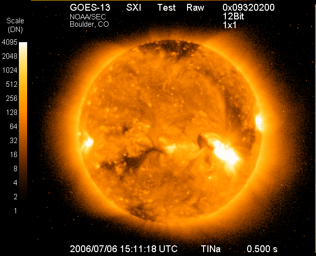
First light from the GOES-13 SXI. Taken July 6, 2006 15:11:18 UTC. Credit: NOAA.
A part of the GOES Space Environment Monitor (SEM) instrument suite, the SXI was a Wolter Type I grazing incidence X-ray telescope designed to observe the development of solar activity, and it provided real-time prediction of solar-terrestrial disturbances. Each SXI instrument on GOES-13, 14, and 15 had a Teledyne e2v back-thinned, backside-illuminated, 512x580 CCD64 detector. Broadband filters acquired images at several wavelength bands between 6 and 60 Angstroms – i.e. soft X-rays. This maximised the wavelength response at the longer wavelengths where cool coronal features, such as coronal holes, are most prominent. Additionally, the CCD64 had a full-well capacity of over 150,000 electrons and incorporated an anti-blooming drain to minimise overexposing very bright solar activity.
SXI could locate solar flares or coronal holes within 10’s of arcseconds without restriction on area or intensity. By supporting a 42-arcmin field of view, the full-disk images captured by SXI extended beyond the solar limb to observe features rotating onto and off the 32-arcmin diameter solar disk. A regular sequence of exposures at one-minute intervals covered the full dynamic range required to monitor solar activity. Once a flare location was pinpointed, scientists could use that information to help predict the magnitude, arrival time, and spectrum of energetic particle events.
The imaging technology incorporated in SXI improved NOAA’s ability to predict solar storms. Prior solar imaging instruments on GOES used film, so the upgrade to a digital sensor improved quality and made image distribution – not to mention acquisition – much easier. Before SXI, solar forecasters depended on detecting the Hydrogen Alpha (Ha) spectral line, a specific wavelength of red light emitted by hydrogen atoms in the Sun’s atmosphere. Ha images revealed solar activity close to the chromosphere, or surface of the Sun, while X-rays extend into the corona – the outermost layer of the Sun’s atmosphere. Thus, X-rays can identify active regions that will rotate onto the solar disk within a couple of days, giving forecasters more time.
SXI also supports autonomous sequence control. For instance, the SXI would be set to recognise solar flares based on internal detection algorithms or data from other satellites. In the event of a flare, SXI would switch to configured image sequences with different image exposures and cadences.
Video of solar activity between June 14th, 2011 and July 12th, 2012. Credit: Professor Daniel Wilkinson, at NOAA, and clearfixsounds. Music by Embers.
The 3rd generation of GOES satellites had a design life of seven years, but they carried excess fuel to allow them to operate for longer. GOES-13 operated for over 12 years, GOES-15 for 10, and GOES-14 is still in orbit, standing by for activation if needed.
The GOES programme is operated by NOAA’s National Environmental Satellite, Data, and Information Service. All data is archived at the NOAA National Geophysical Data Center (NGDC). NOAA continues to support global efforts to combat climate change and study the environment, collaborating with organisations like the World Meteorological Department.
Works Cited
National Oceanic and Atmospheric Organization (NOAA). (Feb. 25, 2025). Space Weather. US Department of Commerce. https://www.noaa.gov/education/resource-collections/weather-atmosphere/space-weather.
eoPortal. (May 29, 2012). GOES-N, O, P. eoPortal. https://www.eoportal.org/satellite-missions/goes-n-o-p.
Bornmann, P. L., Speich, D. M., Hirman, J. W., Pizzo, V. J., Grubb, R. N., Balch, C. C., Heckman, G. (Oct. 18, 1996). GOES solar x-ray imager: Overview and operational goals. Proceedings of SPIE. https://doi.org/10.1117/12.254078.

